Tag Archives: avalanche

Avalanche Warnings in Switzerland Modified

Avalanche Warnings in Switzerland to be modified starting this winter. The SLF is enhancing the precision by subdividing the danger levels. It will indicate whether the danger is towards the bottom end, in the middle or towards the top end of the reported level.

The SLF (Swiss Institute for Avalanche Research) says the new system will provide “users with more precise information for assessing the risk”.

The five danger levels themselves remain unchanged.

The Avalanche Warnings in Switzerland will have subdivisions of the danger levels to indicate where the danger is in the level:

  • Towards the bottom end (-)
  • More or less in the middle (=)
  • Towards the top end (+)

This subdivision is only applied for dry avalanches, and only starting at Level 2.

The purpose is to make it easier for users to interpret the Avalanche Warnings in Switzerland correctly.

Other national avalanche forecasting bodies are watching the change closely.

Avalanche Warnings in Switzerland
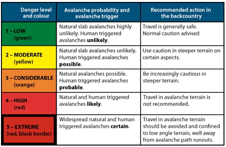
Avalanche warning scale

The SLF explains the new situation in a series of questions and answers:

Why this change?

The SLF has been hearing calls for a more precise representation of the avalanche danger for several years.

For those who engage in snow sports, Level 3 in particular spans a very broad spectrum.

The avalanche forecasters likewise have been wanting to pinpoint the danger with greater precision for some time.

These wishes have now been satisfied with the introduction of the subdivisions.

Why not simply add a danger level?

Additional danger levels would not be feasible in the international arena and would serve little purpose in any case.

According to avalanche forecaster Kurt Winkler, “One advantage of the new system is that it takes findings of psychological research into account.”

The human brain cannot differentiate more than five to seven defined classes.

The danger levels, which are clearly defined, are already aligned with this understanding and are thus being retained.

The classification reflects logical and therefore slow thought processes.

But we can also determine, without any difficulty, a relative ranking within the individual classes.

We make subdivisions of this kind intuitively and thus quickly.

Does the new approach work in practice?

The SLF’s avalanche forecasters have already been allocating subdivisions to all danger assessments over a period of six winters, but has refrained from publishing them.

This large data set was then statistically analyzed in order to review the new approach.

The analysis clearly showed that the differences between the danger level forecast in the avalanche bulletin and the observations reported from the field are much smaller when the subdivision forms part of the picture as well.

In addition, a clear correlation was shown to exist with objectively measurable factors that play a role in the formation of avalanches.

From one subdivision to the next one above, for example, the frequency of whumpfing sounds and of avalanches triggered by people increases and the snowpack stability test results deteriorate.

Since the experimental series also demonstrated that subdividing the danger levels is dysfunctional in the case of wet snow avalanches, subdivisions are not being reported when the snow is wet.

Where the graphical reduction method is being applied, the subdivisions can be taken into account by entering the diagram on the left or right side of the column representing the danger level and then using the diagonal color code.

What is the target audience for the subdivisions and how can they be useful?

Everyone can benefit from the additional information which is provided.

“Those who wish to avoid the most dangerous situations on a given winter’s day can simply stay away from regions where the danger level is 3+ or higher, for instance, and instead either choose to visit a region where the danger is lower or even make other plans for the day,” explains Kurt Winkler.

The subdivisions can be used quantitatively as well.

The calculation of the avalanche risk on the website skitourenguru.ch, for example, takes them into account.

The subdivisions can also be useful when applying the graphical reduction method.

For an approximate assessment, the danger level can still be used in such cases.

Alternatively, based on the subdivision, the user can enter the diagram on the left or right side of the column representing the danger level and then use the diagonal colour code.

Can the new subdivisions be disregarded?

Although, as with any forecast, incorrect assessments are possible, evaluations show that the subdivisions reflect the danger more accurately as a rule.

Disregarding the subdivision bars access to additional information that would facilitate a better assessment of the risk.

“In any event, it is essential to continue taking the danger level seriously,” concludes Kurt Winkler.

“A 3-minus remains a level 3 and indicates ‘considerable avalanche danger’ – it is not to be taken lightly or treated as though it were a 2.”
Forest Service avalanche center at work

Avalanche Nonprofit Merger will Support Forest Service Avalanche Center

New avalanche nonprofit will provide financial aid for Forest Service

NH (Nov. 15, 2022) – Friends of Tuckerman Ravine and White Mountain Avalanche Education Foundation, both longtime nonprofits of Mt. Washington Valley, have merged. The merger will support and promote the Mount Washington Avalanche Center, a Forest Service operation.

Both groups have previously been critical to the success of the Forest Service center, bestowing financial support. This combined entity will enhance the ability to raise money.

“We are very excited about these organizations finally coming together after so many years. Both have the same goals, and now together, we can streamline our efforts to fund the Avalanche Center,” said Jake Risch, president of the new Avalanche Nonprofit – the Mount Washington Avalanche Center Foundation.

This fall, MWAC will host various events in support of the Forest Service :

The 12th annual Eastern Snow and Avalanche Workshop takes place on Nov. 17–18

Winter Backcountry Kickoff Party took place on Nov. 19, in Intervale, NH.

Forest Service avalanche center at work

Uttarkashi avalanche: Did mild earthquake trigger it?

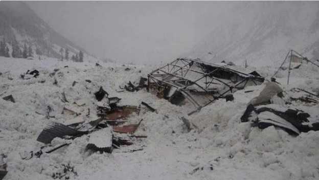
Was the Uttarkashi avalanche triggered by an earthquake a couple days earlier? A 2.5 magnitude earthquake jolted the region on October 2. Just two days before the deadly avalanche hit the group from Nehru Institute of Mountaineering (NIM) at Draupadi ka Danda. Sixteen bodies were recovered by Thursday afternoon, fifteen were still reported missing.

The earthquake epicenter was not far from the Uttarkashi avalanche site. Experienced mountaineers as well as locals are now speculating that the earthquake may have triggered the avalanche.

According to National Center of Seismology the earthquake happened at around 10:43 am on October 2 with its epicentre in Bhatwari tehsil, Uttarkashi district. Significantly, the 25-km trek to Mount Draupadi ka Dana also lies in Bhatwari tehsil.

“Sometimes, even small tremors can cause cracks in the glaciers and the upper layer of snow could dislodge immediately after a small amount of pressure is exerted on it. In the past, we have seen earthquake-triggered-avalanches like the 2015 avalanche around the Mt Everest base camp,” said Love Raj Dharmshaktu, who has scaled Everest seven times.

The SE part of Uttarkashi district, including Bhatwari, falls under either zone IV or zone V of the seismic zone map. Senior geologist and executive director of Uttarakhand State Disaster Management Authority, Piyoosh Rautela, said that earthquakes do trigger avalanches and landslides.

He added: “A detailed investigation is needed to ascertain whether the October 2 quake, which was of low intensity, triggered the Uttarkashi avalanche on October 4.” Jayendra Rana, president of Uttarkashi trekking and mountaineering association, said, “Draupadi ka Danda is a safe peak and we have never heard of any major avalanche there. The October 4 incident occurred just two days after the quake. I think this angle should be explored.”

Uttarkashi avalanche

Indian Avalanche Survivor: ‘Lucky we could somehow breathe’

Indian Avalanche Survivor Aakash Lalwani, one of the rescued climbers, said the wall of snow took everyone down in a matter of seconds and threw them into a deep crevasse. “We were lucky that we could somehow breathe”.

A training expedition in the Himalayas was hit by a massive avalanche on a steep range in northern India, killing at least 16 and leaving about 10 others still missing.

About 15 people had been rescued as of Thursday, two long days after the expedition from the Nehru Institute of Mountaineering (NIM) were caught in the avalanche.

The avalanche struck around 17,000 feet near Mount Draupadi ka Danda-II as the team was returning from the summit. Draupadi ka Danda-II is in the Uttarakhand region.

Most of the Indian avalanche survivor are still in shock according to Vivek Pandey of the Indo-Tibetan Border Police.

Heavy rain and snowfall has limited both air and ground rescue efforts. On Wednesday a halt was called to rescue operations. The weather also posed a challenge to retrieving the bodies of those who died, officials said.

“Considering weather and other conditions, it is a difficult operation, which might continue for a couple of days,” Pandey said.

Many of the missing trainees were trapped in the 60- to 70-foot crevasse for at least two hours. “The hopes of survival are very bleak as the golden period of rescue in such situations is not even a couple of hours,” he said.

Among the dead was accomplished climber Savita Kanswal, the first Indian woman to summit Mount Everest and Mount Makalu. Kanswal, 27, was serving as an instructor on this week’s expedition.

Fourteen trainees were also among those killed, officials said.

Two Indian Air Force helicopters were sent to the region for the search. 

Fatal climbing accidents are common in the Himalayas. In August, the body of a mountaineer was recovered two months after he fell into a crevasse while crossing a glacier in nearby Himachal Pradesh.

Oct. 7, 2022

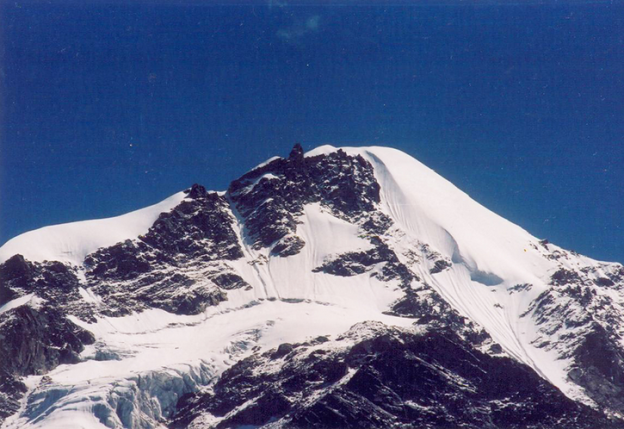
Draupadi Ka Danda II. Scene of large Indian avalanche.
Draupadi Ka Danda II.
Photo: Amar Chandra/Wikimedia Commons

Artificial Intelligence for Avalanche Forecasting?

 Can we use Artificial Intelligence for Avalanche Forecasting?

Even the best forecasters only reach about 75% accuracy in their avalanche predictions.  After all, they are only human. One of the greatest challenges is in the fact that avalanche danger cannot be precisely measured or communicated. It is, therefore, a matter of expert assessment and opinion by humans.

Last season the Swiss Institute for Snow and Avalanche Research successfully tested a first-of-its-kind, artificial intelligence computer program to assist in its avalanche forecasts. The SLF is a world leader in the field of avalanche forecasting and pushes the boundaries of avalanche forecasting methods.

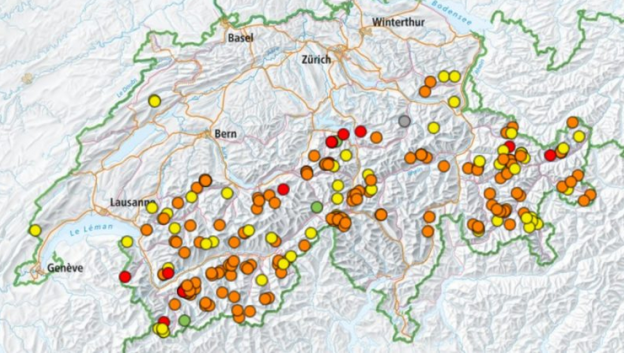
SLF human observers collect measurements from over 120 different remote automatic weather stations located across the Swiss Alps. They then analyze the data, make interpretations, and combine opinions into a single bulletin published at 5 pm each day.

SLF researchers tested the new AI model as a “second opinion” against the human-made forecasts. In many cases the model agreed, but sometimes it did not. The differences are then reviewed.

The new Artificial Intelligence for Avalanche Forecasting model was trained using more than two decades-worth of weather and forecast information. SLF researchers now estimate the program is about 75% accurate in its model predictions. SLF forecaster Frank Techel describes the Artificial Intelligence for Avalanche Forecasting:

The computer analyses the data in a different way than we do. That’s why it occasionally arrives at a slightly different conclusion. The computer forecast is very useful, especially for drawing exact boundaries between regions in which different danger levels prevail.”

The model, however, is limited to dry-snow avalanches.  The SLF is planning on introducing a new Artificial Intelligence for Avalanche Forecasting system capable of modeling wet-snow avalanches as well as snowpack stability next season.

Those interested in learning more about avalanche safety or science can visit the Avalanche Center (avalanche-center.org) and its affiliated Avalanche Institute for online courses.

Can we use Artificial Intelligence for Avalanche Forecasting?
Can we use AI for Avalanche Forecasting?

Dog Presumed Dead In Avalanche Is Found Alive Days Later

A brave dog, presumed dead in an avalanche, was found alive several days later at a trailhead.

An avalanche triggered by a skier in Colorado hit a skier and snowboarder on Thursday, and their dog.

The skier deployed an airbag before being partially buried under snow. However, they lost sight of their four-legged friend amidst the chaos.

Fortunately for the skier and snowboarder, they were uninjured and able to make it out under their own power.

After looking all over for the dog presumed dead in the avalanche, the owners and a search crew had basically given up hope.

They left the scene and assumed the dog had died in the avalanche.

Search and rescue members didn’t see any signs of tracks.

Miraculously, however, after several days of being missing, the dog was found at a trailhead of Monarch Pass.

The reunion was incredibly emotional.

This isn’t the first time a pet has been rescued after dire circumstances in the Colorado mountains this season.

In December a video posted on YouTube showed skiers digging out a dog who had been under snow for 20 minutes after an avalanche.

Despite the positive outcome this time, Lazar reaffirmed that the best course of action when caught in an avalanche was for riders to keep an eye on their pet and only attempt to save them once it’s safe to do so

“We don’t want dogs to wear avalanche transceivers. We want people to be searchable by transceivers and not mixable with potential dogs with transceivers on,” Lazar said.

That’s one story that this courageously good boy or girl will remember for the rest of their dog years.

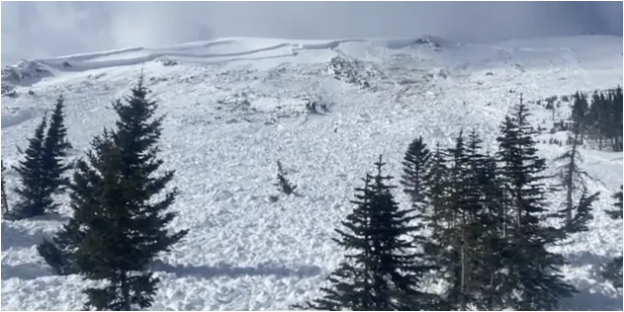
Site where a dog presumed dead in an avalanche was initially buried. It was found later.
Site where a dog presumed dead in an avalanche was buried.

Seward Highway avalanche – road reopens

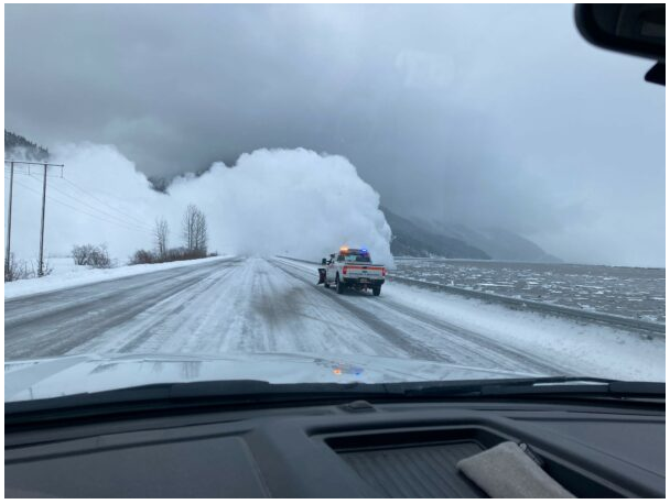
A Seward Highway avalanche closed the road for much of the day Friday. It was between Bird Creek and the Portage turnoff. The avalanche severed the only road access between Anchorage and the Kenai Peninsula for more than eight hours.

The Seward Highway avalanche hit at Mile 91.5 and the debris on the roadway was up to 15 feet high in spots, said a spokesperson for the DoT. The highway reopened around 2 p.m. but drivers should remain cautious.

“Travel is going to be wet and slick and bumpy. They’ve cleared all the snow but it’s definitely not down to dry highway measures by any means.”

Crews set off artillery to trigger 20 other avalanches along the highway on Friday. Also on Friday, several snow slides closed the Old Glenn Highway near the Old Knik River Bridge.

Farther north, snow slides near Summit Lake closed the Richardson Highway from mile 186 to 218.

The Hatcher Pass Avalanche Center also warned of very dangerous avalanche conditions in the area. It issued an avalanche warning early Friday, and it says the Hatcher Pass Road will be closed at mile 11 through the weekend due to avalanche activity.

National Weather Service meteorologist Michael Kutz said Anchorage has been having one of the wettest years on record so far. Snowfall this February is nearly three times higher than average, and rainfall this year is more than four times above normal, Kutz said. 

Seward Highway Avalanche

Rain and Snow in Anchorage

Rain and snow have been falling in Anchorage and other areas of Southcentral since the beginning of the week. Which has led to treacherous road conditions in parts of town. Areas of the Mat-Su have been hit with heavy snow. Power to thousands of homes has been knocked out.

As of Friday evening, about 300 homes still did not have power. The Mat-Su school district canceled in-person classes on Friday for the third day in a row due to road conditions and winter weather.

Canada fights rising risk with lots of avalanche bombing

Jan 20 – British Columbia is rolling out the artillery and bombs for avalanche bombing. There have been closures on some major roads for the first time in decades as the province grapples with record snowfall and rain.

The province, third-largest by population, uses helicopter avalanche bombing, remote-triggered explosives, and howitzers to keep roads open. But nonetheless critical routes to Vancouver are being disrupted by avalanche control.

Extreme weather, including November’s torrential precipitation, a deep freeze in late December and an early January thaw, has weakened the snowpack. Mountain slopes are more prone to avalanches that can release without warning.

Avalanche bombing requires closing sections of roads while teams use explosives to pre-emptively trigger slides, which prevents the snowpack from becoming deep and unstable.

Record amounts of control actions

A section of Highway 1 through Fraser Canyon northeast of Vancouver needed avalanche control for the first time in 25 years.

On Highway 99 north of Vancouver avalanche control actions are three times the seasonal average. Some paths have produced avalanches big enough to hit the highway for the first time in over a decade.

Avalanche bombing in Allison Pass further south on Highway 3 has also been above average.

These highways were all damaged in November by floods. A busy avalanche control season is putting further strain on resources. The Coquihalla Highway near Hope just reopened on Wednesday. And record snow along with avalanche risk delayed repairs to Highway 1 through the Fraser Canyon.

Rogers Pass

Further east avalanche teams in Rogers Pass, which runs below 135 slide paths in Glacier National Park, are dealing with more snow than usual. Control missions are also above average.

Approximately 3,000 vehicles traverse Rogers Pass every day in winter. A major Canadian Pacific rail line runs along the highway although it has a long tunnel under the top of the pass.

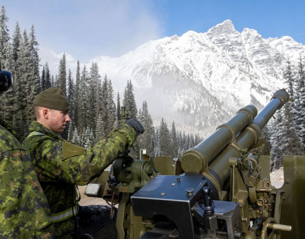
Rogers Pass avalanche bombing involves artillery soldiers who are stationed in Rogers Pass in winter. They use a howitzer to fire shells into loaded avalanche paths along the highway.

“Our goal is to bring down as much snow as we can and bring the hazard down to a point where it’s safe to open the highway,” said Jim Phillips, acting avalanche operations coordinator for Parks Canada.

The Rogers Pass program has been running since the highway opened in 1961. Before that, and before they built their tunnel, CP trains ran a high risk of deadly snow slides. One killed 62 railway workers in 1910.

So far this winter the team has fired 333 howitzer rounds, produced 197 controlled avalanches and closed the highway for 43 hours over seven separate days.

Helicopter Avalanche Bombing

Phillips said his team also uses heli-bombing and remote-trigger systems to set off detonations, and spends C$600,000 ($480,346) a year on explosives alone.

“It’s a balancing act. You want to keep traffic moving and minimize closures, but also minimize risk to people using the transportation corridor,” he added.

Avalanche control is typically needed until late April or early May.

Avalanche bombing in Rogers Pass. November 22, 2019. MCpl PJ Letourneau/Canadian Forces
November 22, 2019. MCpl PJ Letourneau/Canadian Forces. Avalanche bombing in Rogers Pass.
Forest Service avalanche center at work

Sierra Avalanche Center mission

The Sierra Avalanche Center (SAC) is not a typical public service found in just any town. Although the Forest Service does have many such centers throughout the western US.

Nearly every day of the winter paid public forecasters grab their gear and head to the mountains for a day of skiing.

Sierra Avalanche Center Board of Directors President James Brown was once buried by an avalanche himself while ski touring in Canada. The snowpack conditions there are much different and more complex than in the Sierra.

A couple of forest service employees established SAC in 2004. Brandon Schwartz now works as the lead forecaster as a Forest Service employee.

The priority and purpose of SAC is to produce the avalanche forecast every winter morning, which includes two basic components. The avalanche danger — low, moderate, considerable, high, or extreme — and then what avalanche problem or problems backcountry users are likely to encounter that day.

The forecasters’ jobs are to assess avalanche hazards by traveling through the snow-covered backcountry.

Brown stated that SAC has come a long way since its first inception, when those who wanted the forecast would have to call a number. These days, backcountry users can get a quick glimpse of the forecast by following SAC on Instagram, Facebook, or Twitter, or by visiting their website to view the full and in-depth avalanche forecast.

“The avalanche community in general has come a really long way from making avalanche decisions based on colloquialisms …” Brown said. “… people used to say, as long as you don’t ski 24 hours after a storm, you’re OK. There is a certain grain of truth to that, especially in the Sierra, but that’s obviously not a good decision-making tool.”

In order to fund themselves the Forest Service Sierra Avalanche Center holds regular events and seeks donations.

Those interesting in supporting the US Forest Service avalanche center can donate, or attend events held in support of the avalanche center, such as a clinic being held 6 to 9 p.m. Dec. 17 at Palisades Tahoe. The event will host influential skiers and snowboarders in the community — such as Michelle Parker, Jeremy Jones, and Elyse Saugstad — who will be speaking about avalanche safety. Donations will be accepted.

December 8, 2021

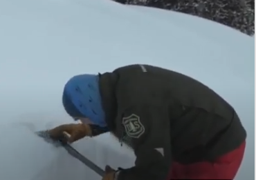
A Forest Service forecaster takes a break from a day of skiing to examine the snow.

Waterton townsite avalanche – No injuries or structure damage

WATERTON PARK, AB – A Waterton townsite avalanche resulted in a close call in Waterton Lakes National Park in Canada.

This past weekend a class-4 avalanche roared down Bertha Peak. Which is just outside the small resort community.

The avalanche dumped 10 metres of debris on the Bertha Falls trail and stopped just ahead of Evergreen Avenue South. Entry to the town using that street past Cameron Falls is not recommended due to the risk of further avalanches.

Additionally, the Akamina Parkway is closed until further notice. Pedestrian access on Akamina and Red Rock parkways remains open. The parkway will reopen to vehicles when conditions improve.

Fortunately, no injuries were reported, and no structures were damaged. The risk of avalanches, and another townsite avalanche, has increased significantly in the park. This is due to large snow falls, extreme wind gusts and rising temperatures.

Jan 13, 2022 | 7:05 AM

Waterton, location of a townsite avalanche
Waterton, where a townsite avalanche occurred